South Interbay
Preferred Alternative: Galer Street Station/Central Interbay
The Galer Street Station/Central Interbay Alternative would exit a tunnel portal at West Republican Street and Elliott Avenue West and transition to an elevated guideway. The guideway would continue northwest along Elliott Avenue West to an elevated Smith Cove Station at the West Galer Street Flyover. The elevated track would continue north over the Magnolia Bridge, through the Interbay Armory, and along the west side of the Interbay Athletic Complex.
Station location: The station at Smith Cove would be located above and straddling the West Galer Street Flyover.
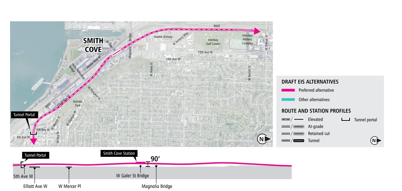
Diagrams are not to scale and all measurements are approximate for illustration purposes only. | Click on image to enlarge
South Interbay - Other alternatives
The Prospect Street Station/15th Avenue Alternative would exit a tunnel portal at West Republican Street and Elliott Avenue West and transition to an elevated guideway. The guideway would continue northwest along Elliott Avenue West and enter the Smith Cove Station just north of West Prospect Street. From the Smith Cove Station, the elevated guideway would transition into a retained cut before again becoming an elevated guideway in the center of 15th Avenue West.
Station location: The elevated station at Smith Cove would be located north of Kinnear Park on the east side of Elliott Avenue West.
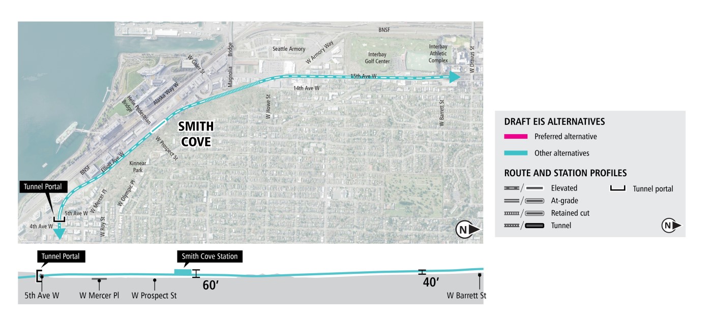
Diagrams are not to scale and all measurements are approximate for illustration purposes only. | Click on image to enlarge
The Prospect Street/Central Interbay Alternative would continue as a tunnel from downtown to a tunnel portal on the east side of Elliott Avenue West near West Prospect Street. The alternative would continue north from the tunnel portal in a retained cut to the Smith Cove Station just north of West Prospect Street. From the station, the alternative would transition to an elevated guideway and continue north along West Armory Way and west of the Interbay Athletic Complex to connect to the Elevated 14th Avenue Alternative in the Interbay/Ballard segment.
Station location: The retained cut station in Smith Cove would be located north of West Prospect Street on the east side of Elliott Avenue West.
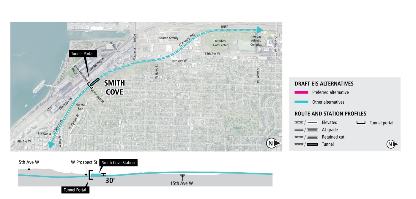
Diagrams are not to scale and all measurements are approximate for illustration purposes only. | Click on image to enlarge
The alternatives presented were developed through years of planning and community engagement. To learn more about the alternatives raised but not carried forward for study in the Draft EIS, see Further Studies: Community Engagement Summary (2023), and Appendix M from the previous WSLE Draft EIS.